Béthelainville Sadržaj/Садржај Demografija | Vidi još | Reference | Literatura | Vanjske veze | Navigacijski meni49°10′03″N 5°14′07″E / 49.1675°N 5.23527777777778°E / 49.1675; 5.23527777777778"National Institute of Statistics and Economic Studies"Encyclopedia of Contemporary French CultureThe Discovery of France: A Historical GeographyFranceThe Cambridge Illustrated History of FranceFrance since 1870: Culture, Society and the Making of the RepublicFrance: A Reference Guide from the Renaissance to the Present (European Nations)InseeBéthelainville na stranici Nacionalnog geografskog instituta FrancuskeBéthelainville na stranici organizacije INSEENajbliža naselja (kilometraža, pravac i koordinate)Položaj mesta Béthelainville na mapi Francuske (sa osnovnim podacima o mestu)Plan naselja Béthelainville na mapi (Mapquest)uuproširite
Departman Meuse u FrancuskojFrancuska, članci u začetku
 fr.FrancuskojLorenaMeza1999
(function()var node=document.getElementById("mw-dismissablenotice-anonplace");if(node)node.outerHTML="u003Cdiv class="mw-dismissable-notice"u003Eu003Cdiv class="mw-dismissable-notice-close"u003E[u003Ca tabindex="0" role="button"u003Ezatvoriu003C/au003E]u003C/divu003Eu003Cdiv class="mw-dismissable-notice-body"u003Eu003Cdiv id="localNotice" lang="sh" dir="ltr"u003Eu003Cpu003EOdnedavno informacije vezane uz srpskohrvatsku Wikipediju možete pratiti putem u003Cspan class="plainlinks"u003Eu003Ca rel="nofollow" class="external text" href="https://discord.gg/Vh7hnsV"u003EDiscordu003C/au003Eu003C/spanu003E grupe.nu003C/pu003Eu003C/divu003Eu003C/divu003Eu003C/divu003E";());
Béthelainville
Idi na navigaciju
Idi na pretragu
| Betlenvil Béthelainville | |
|---|---|
| |
| Osnovni podaci | |
| Država | |
Region | Lorena |
Departman | Meuse |
Okrug | Verden |
Kanton | Šarni sir Mez |
| Stanovništvo | |
| Stanovništvo (2011-01-01) | 177[1] |
| Gustina stanovništva | 15,91 st./km² |
| Geografija | |
| Koordinate | 49°10′03″N 5°14′07″E / 49.1675°N 5.23527777777778°E / 49.1675; 5.23527777777778 |
| Vremenska zona | UTC+1, ljeti UTC+2 |
| Nadmorska visina | 268 m |
| Površina | 11.94 km² |
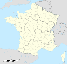
 Betlenvil Betlenvil (Francuske) | |
| Ostali podaci | |
Poštanski kod | 55100 |
INSEE kod | 55047 |
Betlenvil (fr. Béthelainville) je naselje i opština u severoistočnoj Francuskoj u regionu Lorena, u departmanu Meza koja pripada prefekturi Verden.
Po podacima iz 1999. godine u opštini je živelo 177 stanovnika, a gustina naseljenosti je iznosila 14 stanovnika/km². Opština se prostire na površini od 11,94 km². Nalazi se na srednjoj nadmorskoj visini od 268 metara (maksimalnoj 343 m, a minimalnoj 232 m).
Sadržaj/Садржај
1 Demografija
2 Vidi još
3 Reference
4 Literatura
5 Vanjske veze
Demografija |
1962. | 1968. | 1975. | 1982. | 1990. | 1999. | 2011. |
|---|---|---|---|---|---|---|
| 175 | 182 | 195 | 195 | 189 | 177 | 190 |
- Grafik promene broja stanovnika u toku poslednjih godina

Vidi još |
- Departmani Francuske
- Spisak departmana Francuske po gustini naseljenosti
- Spisak departmana Francuske po površini
- Spisak departmana Francuske po broju stanovnika
- Spisak opština u departmanu Meza
Reference |
↑ "National Institute of Statistics and Economic Studies". http://www.insee.fr/en/home/home_page.asp.
Literatura |
Alexandra Hughes, Alex Hughes, Keith A Reader, Keith Reader, ur. (2001). Encyclopedia of Contemporary French Culture (Routledge; Routledge World Reference edition izd.). ISBN 0415263549. http://books.google.com/books/about/Encyclopedia_of_Contemporary_French_Cult.html?id=getDruRAaqgC.
Robb, Graham (2008). The Discovery of France: A Historical Geography. W. W. Norton & Company. ISBN 0393333647. http://books.google.com/books?id=SfUUGiEyd24C&dq=The+Discovery+of+France:+A+Historical+Geography&hl=en&sa=X&ei=mQMSU7SsIYWJogTHtoCAAw&ved=0CDkQ6AEwAA.
Ardagh, John (1991). France (Cultural Atlas of izd.). Facts on File. ISBN 081602619X. http://books.google.com/books?id=EWSfQgAACAAJ&dq=France+%28Cultural+Atlas+of%29&hl=en&sa=X&ei=twYSU-27BtH1oASRtoDwDw&ved=0CDQQ6AEwAA.
Jones, Colin (1999). The Cambridge Illustrated History of France (Cambridge Illustrated Histories izd.). Cambridge University Press. ISBN 0521669928. http://books.google.com/books?id=EVNGNIojGgMC&printsec=frontcover&dq=The+Cambridge+Illustrated+History+of+France&hl=en&sa=X&ei=sQcSU5r-F8beoASOqIK4Bw&ved=0CCsQ6AEwAA#v=onepage&q=The%20Cambridge%20Illustrated%20History%20of%20France&f=false.
Sowerwine, Charles (2009). France since 1870: Culture, Society and the Making of the Republic (2nd izd.). Palgrave Macmillan. ISBN 0230573398. http://books.google.com/books?id=pBMiAQAAIAAJ&q=France+since+1870:+Culture,+Society+and+the+Making+of+the+Republic&dq=France+since+1870:+Culture,+Society+and+the+Making+of+the+Republic&hl=en&sa=X&ei=iggSU-63B8HpoATh_YCICA&ved=0CCsQ6AEwAA.
Roberts, William J. (2004). France: A Reference Guide from the Renaissance to the Present (European Nations) (European Nations izd.). Facts on File. ISBN 0816044732. http://books.google.com/books?id=ogdZu2l2CYkC&printsec=frontcover&dq=France:+A+Reference+Guide+from+the+Renaissance+to+the+Present+%28European+Nations%29&hl=en&sa=X&ei=EQkSU7n_JdLooASzlIKgDA&ved=0CCsQ6AEwAA#v=onepage&q=France%3A%20A%20Reference%20Guide%20from%20the%20Renaissance%20to%20the%20Present%20%28European%20Nations%29&f=false.
Vanjske veze |
- Baza podataka: Insee ((fr))
Béthelainville na stranici Nacionalnog geografskog instituta Francuske ((fr))
Béthelainville na stranici organizacije INSEE ((fr))
Najbliža naselja (kilometraža, pravac i koordinate) ((fr))
Položaj mesta Béthelainville na mapi Francuske (sa osnovnim podacima o mestu) ((fr))- Plan naselja Béthelainville na mapi (Mapquest)
| ||||||
| ||||||||||||
Kategorije:
- Departman Meuse u Francuskoj
- Francuska, članci u začetku
(RLQ=window.RLQ||[]).push(function()mw.config.set("wgPageParseReport":"limitreport":"cputime":"0.548","walltime":"1.253","ppvisitednodes":"value":8689,"limit":1000000,"ppgeneratednodes":"value":0,"limit":1500000,"postexpandincludesize":"value":180694,"limit":2097152,"templateargumentsize":"value":19442,"limit":2097152,"expansiondepth":"value":13,"limit":40,"expensivefunctioncount":"value":1,"limit":500,"unstrip-depth":"value":0,"limit":20,"unstrip-size":"value":1218,"limit":5000000,"entityaccesscount":"value":0,"limit":400,"timingprofile":["100.00% 1090.437 1 -total"," 12.94% 141.146 1 Šablon:Naseljeno_mesto_u_Francuskoj2"," 11.91% 129.861 1 Šablon:Grad"," 9.70% 105.722 7 Šablon:Citation/core"," 7.88% 85.883 1 Šablon:DemografijaFR"," 7.79% 84.995 6 Šablon:Cite_book"," 5.81% 63.374 2 Šablon:Navbox"," 5.35% 58.322 1 Šablon:Reflist"," 4.09% 44.568 1 Šablon:Insee"," 3.94% 42.992 1 Šablon:Departman_Meza_u_Francuskoj"],"scribunto":"limitreport-timeusage":"value":"0.022","limit":"10.000","limitreport-memusage":"value":1154376,"limit":52428800,"cachereport":"origin":"mw1251","timestamp":"20190629191828","ttl":2592000,"transientcontent":false););"@context":"https://schema.org","@type":"Article","name":"Bu00e9thelainville","url":"https://sh.wikipedia.org/wiki/B%C3%A9thelainville","sameAs":"http://www.wikidata.org/entity/Q1049406","mainEntity":"http://www.wikidata.org/entity/Q1049406","author":"@type":"Organization","name":"Doprinositelji projektima Wikimedije","publisher":"@type":"Organization","name":"Wikimedia Foundation, Inc.","logo":"@type":"ImageObject","url":"https://www.wikimedia.org/static/images/wmf-hor-googpub.png","datePublished":"2014-02-26T05:32:09Z","dateModified":"2016-07-15T00:48:15Z","image":"https://upload.wikimedia.org/wikipedia/commons/8/85/Defaut.svg"(RLQ=window.RLQ||[]).push(function()mw.config.set("wgBackendResponseTime":156,"wgHostname":"mw1327"););